
I became part of this project during my ERCIM Alain Bensoussan fellow period at IIT, CNR, Pisa in Italy. The problem of aerial photography matching and stitching became one of my main research interest for several years, resulting in many publications in the area of key point detection, feature matching and outlier removal.
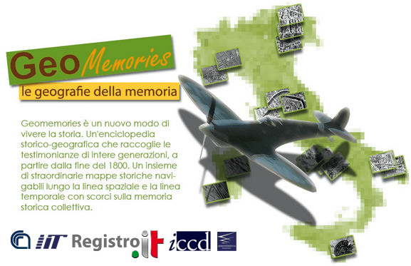
 The GeoMemories project is well described in this publication, showing its potential use for geospatial monitoring and aerial archaeology. The landscape has gone through many changes, often due to human intervention.
- GeoMemories – A Platform for Visualizing Historical, Environmental and Geospatial Changes of the Italian Landscape.
M. Abrate, C. Bacciu, A. Hast, A. Marchetti, S. Minutoli, M. Tesconi.
ISPRS International Journal of Geo-Information. Special issue: Geospatial Monitoring and Modelling of Environmental Change, Journal. pp. 432-455. 2013.@Article{ijgi2020432, AUTHOR = {Abrate, Matteo and Bacciu, Clara and Hast, Anders and Marchetti, Andrea and Minutoli, Salvatore and Tesconi, Maurizio},TITLE = {GeoMemories—A Platform for Visualizing Historical, Environmental and Geospatial Changes in the Italian Landscape},JOURNAL = {ISPRS International Journal of Geo-Information},VOLUME = {2},YEAR = {2013},NUMBER = {2},PAGES = {432--455},URL = {http://www.mdpi.com/2220-9964/2/2/432},ISSN = {2220-9964},DOI = {10.3390/ijgi2020432}}
 This paper describes how to correct uneven illumination in aerial photography (but can also be used in other areas). The main contribution shows how objects like rivers and fields will preserve their darker or lighter attributes, while the main illumination is corrected.
- Improved Illumination Correction that Preserves Medium Sized Objects.
A. Hast, A. Marchetti.
Machine GRAPHICS & VISION, Vol. 23, no.1/2, Journal. pp. 3-20. 2014.@article{Has14a, author = {A. Hast and A. Marchetti}, title = {Improved Illumination Correction that Preserves Medium Sized Objects}, journal = {Machine GRAPHICS & VISION}, pages = {3--20}, volume = {23}, year = {2014}}
 This was the very first paper I wrote together with my colleagues at CNR in Pisa. It shows the value of the project and it discusses some of the challenges and solutions.
- Geomemories – a Spatial-Temporal Atlas of the Italian Landscape.
A. Marchetti, A. Hast, B. Rapisarda, J. Shepherd, M. Tesconi.
International Symposium on Virtual Reality, Archaeology and Cultural Heritage, Short Paper. pp. 41-44. 2011.
@inproceedings{Mar11a, author = {A. Marchetti and A. Hast and B. Rapisarda and J. Shepherd and M. Tesconi}, title = {Geomemories - a Spatial-Temporal Atlas of the Italian Landscape}, booktitle = {International Symposium on Virtual Reality, Archaeology and Cultural Heritage}, pages = {41--44}, note = {Short Paper}, year = {2011}}
 This paper was presented at the Computer Applications and Quantitative Methods in Archaeology (CAA) Conference. Stereo visualisation of historical aerial photographs can be a valuable tool in the field of aerial archaeology. Visualising in stereo gives a much better understanding of these photographs since the environment and buildings appear to be 3D
- Stereo Visualisation of Historical Aerial Photos as a Valuable Tool for Archeological Research.
A. Hast, M. Marchetti.
Computer Applications and Quantitative Methods in Archaeology, CAA, Poster and Extended Abstract. pp. 1-3. 2015.@inproceedings{Has15a, author = {A. Hast and M. Marchetti}, title = {Stereo Visualisation of Historical Aerial Photos as a Valuable Tool for Archeological Research}, booktitle = {Computer Applications and Quantitative Methods in Archaeology, CAA}, pages = {1--3}, note = {Poster with Paper}, year = {2015}}
 In the so called Operation Crossbow the photographic interpreters of RAF at Medmenham in Buckinghamshire used a stereoscope, which allowed the photographic interpreters to study the landscape in 3D. This device made it possible to view a stereoscopic pair of images as a single three-dimensional image or stereogram. These photos were available thanks to meticulously photographing the landscape of occupied Europe. This paper shows some examples of how important stereo really is.
- Stereo Visualisation of Historical Aerial Photos – a Valuable Digital Heritage Research Tool.
A. Hast, M. Marchetti.
Digital Heritage (Vol 2), Short Paper. pp. 663-666. 2015.@inproceedings{Has15a, author = {A. Hast and M. Marchetti}, title = {Stereo Visualisation of Historical Aerial Photos - a Valuable Digital Heritage Research Tool}, booktitle = {Digital Heritage (Vol 2)}, pages = {663--666}, note = {Short Paper}, year = {2015}}
 This paper shows how stereo extraction can be done without much of human intervention. This makes it possible to create stereo images to be displayed with stereo projectors etc. The method includes key point detection, feature matching and outlier removal, as well as illumination correction.
- Towards Automatic Stereo Pair Extraction for 3D Visualisation of Historical Aerial Photographs.
A. Hast, A. Marchetti.
IC3D 2014, International Conference on 3D Imaging., Full Paper. pp. 1-8. 2014.@inproceedings{Has14a, author = {A. Hast and A. Marchetti}, title = {Towards Automatic Stereo Pair Extraction for 3D Visualisation of Historical Aerial Photographs}, booktitle = {IC3D 2014, International Conference on 3D Imaging}, pages = {1--8}, year = {2014}}
 This paper shows how a synthetic view can be constructed from a pair of stereo images. This makes it possible to view the images rotated 90 degrees, i.e. in the direction of the flight of the airplane.
- Automatic 3DS Conversion of Historical Aerial Photographs.
F. Malapelle, A. Hast, A. Fusiello, B. Rossi, P. Fragneto, A. Marchetti.
IC3D 2015, International Conference on 3D Imaging., Full Paper. pp. 1-7. 2015.@inproceedings{Mal15a, author = {F. Malapelle and A. Hast and A. Fusiello and B. Rossi and P. Fragneto and A. Marchetti}, title = {Automatic 3DS Conversion of Historical Aerial Photographs}, booktitle = {IC3D 2015, International Conference on 3D Imaging}, pages = {1--7}, year = {2015} }
 This poster was presented by my Italian colleagues at a conference in Rome, and was the result of a collaboration between groups in Belgium, Spain and Italy.
- Stereo Visualisation of Historical Aerial Photos – an Useful and Important Aerial Archeology Research Tool.
A. Hast, C. Capurro, D. Nollet, D. Pletinckx, B. Vilas Estevez, M. Carrero Pazos, J. M. Eguileta Franco, A. Marchetti.
Second International Conference of Aerial Archaeology, Full Paper. 2016.@inproceedings{Has16a, author = {A. Hast and C. Capurro and D. Nollet and D. Pletinckx and B. Vilas and B. Vilas Estevez and M. Carrero and M. Carrero Pazos and M. Eguileta and M. Eguileta Franco and A. Marchetti}, title = {Stereo Visualisation of Historical Aerial Photos - an Useful and Important Aerial Archeology Research Tool}, booktitle = {Second International Conference of Aerial Archaeology}, year = {2016}}
